Picto Diary - 16 July 2015 - Multistrada Shakedown Day 2
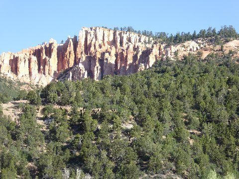
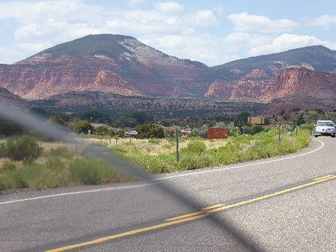
Above: East facing cliff on US 89 midway between Mt. Carmel Junction and junction UT SR 12. 16 July 2015.
Motorcycle. Go. See.
Second day shakedown ride of 2015 Ducati Multistrada.
Yesterday, 15 July 2015.
SR 248, US40, US189, I-15, SR 132 to Ephraim.
US 89 to Mr. Carmel Junction. Half way between Phoenix, AZ and Park City, UT. Spent the night
US 89 to Hatch.
Today, 16 July 2015.
County Road up Markagunt Plateau.
County Road to US 89
US 89, SR 12 to Cannonville.
County Road to Kodachrome Basin. County Road in search of Grovesner Arch.
County Road to Cannonville.
SR 12, SR24, I-70, US 50, I-15, US 189, US 40, US 248 to Park City.
Round trip 750 miles.
The imaged cliff, basking in pre 9:00 AM, oblique, sunlight may have a name but likely few know what it is. There are thousands of structures like this in the southern Utah kaleidoscope landscape. Such sights seem commonplace and repetitive. Yet, I cannot help but marvel, awe stricken, as I glance left, perhaps for the first time here on this oft traveled road, at this obscure piece of Utah landscape.
I am convinced there is something about the effect of scenic land on humans akin to the sating of other human appetites. Savoring vistas here on US89 in early morning soothes... elevates. The effect is amplified by the sweet purr of the Ducati twin.
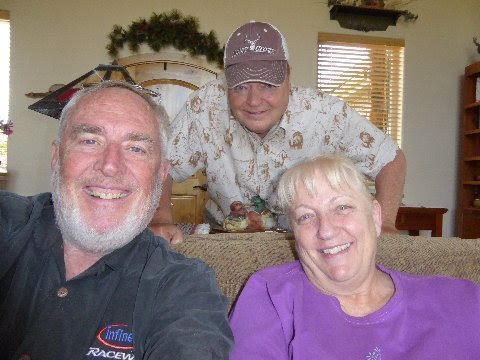
Above: The Bishop, Deer Slayer, and Hippo. On Markagunt.
Hippo and Mwah (sic) best friends in high school. Amongst the most successful people I know at what is most important in life. Two hunter hermits who realized great success in performing civilization's most important task: raising a better generation than the tired one now leaving the scene. Son Q recently received Naismith Award as America's best High School Basketball Coach.
I ate eggs (fried, over hard) and bacon at the Thunderbird Restaurant, Mt. Carmel Junction, and started my ride north, back up US 89, at 8:15 AM.
I took a county road west heading the Markagunt Plateau and arrived at Deer Slayer's and Hippo's very remote home about 9:15 AM.
I asked Hippo how his health was. He pointed at the buck rack high on his wall and said, "well, it was good enough to enable me to get that big buck on the remote flank of the Blues last deer season."
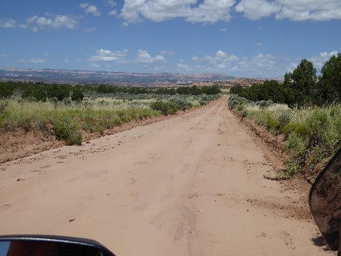
Above: Cottonwood Canyon (Grand County) road. Looking northwest toward Bryce Canyon National Park. 16 July 2015.
Dusty, sandy, Cottonwood Canyon road leaves the spur road departing from SR 12 to get to Kodachrome Basin State Park and extends south, forty miles or so, to US 89, twenty miles east of Kanab.
Somewhere along Cottonwood Canyon road is Grovesner Arch. I asked the BLM ranger at Cannondale how far Grovesner Arch was off the Kodachrome spur. "1 mile," she said.
After riding the increasingly sandy, dirt road three miles in search the arch I figured I had missed a turn somewhere. I turned around and took a branch to the left and rode it two miles or so... until I ran into a gate. I opened the gate and rode to another gate... I figured, correctly, in hindsight, that the arch wasn't this direction either.
I returned to Kodachrome Basin and asked the state ranger (a different person than the BLM ranger in Cannondale) where I had missed finding the arch. She said Grovesner Arch was actually 11 miles, not one mile, down the dirt road. I had already spent forty five minutes in my errant wandering and didn't take the time to go back arch hunting. I was still over 300 miles from Park City and it was already 11:45 AM. Besides, the road became sandier I headed further south. Riding a motorcycle in such tricky terrain in such a remote area is better done with a companion or two.
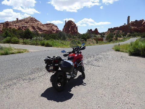
Above: The Duc at Kodachrome Basin. 16 July 2015.
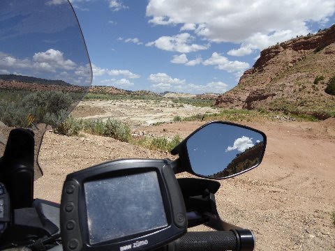
Above: Paria River. 16 July 2015. Colorado tributary running from Paunsaugunt Plateaur to the Grand Canyon.
Image captured from spur road connecting SR 12 with Kodachrome Basin.
"It is formed in southern Utah, in southwestern Garfield County from several creeks that descend from the edge of the Paunsaugunt Plateau, meeting just north of Tropic. It flows SSE across Kane County and Grand Staircase-Escalante National Monument. Along the Arizona state line, it descends through the Vermilion Cliffs in the Paria Canyon and onto the Paria Plateau. It joins the Colorado from the northwest approximately 5 mi (8 km) southwest of Page, Arizona and the Glen Canyon Dam. The lower 20 mi (32 km) of the river are within the Paria Canyon-Vermilion Cliffs Wilderness, which is administered by the Bureau of Land Management; a permit is required for any overnight visit. The Paria is essentially a large creek and is not navigable." Wikipedia
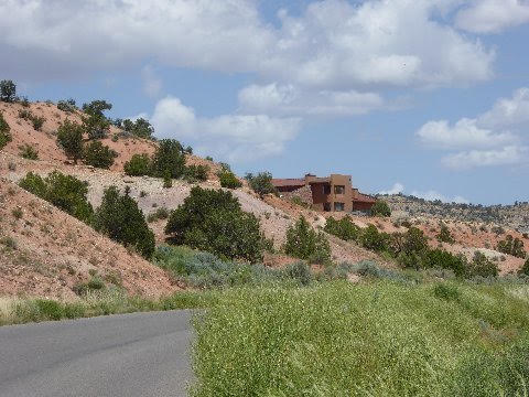
Above: Residence, Cannondale, UT. 16 July 2015.
Want remote living? Try Cannondale. 350 miles to the nearest Costco... in either of Denver, Phoenix, or Salt Lake City.
You can't help riding through this country without being aware of how dry it is... how dependent it is on snow pack and spring rains. This is desert country. Utah has an average annual rainfall of only 7 inches a year.
The people who built this newly completed house, miles from the nearest commercial settlement... were they comfortable about their water supply? Likely they dug a well. How secure is that supply?
On balance, though living through a multi-year drought affecting the mountain west, Utah water supply is in reasonable shape. Despite having only half the average annual snow pack this season, May and June rains were far above average. Also, this particular part of the state had near normal snow pack.
California, though, unlike Utah (at least near term), is in real trouble. To be sure, Utah has only 8% of California's population and ample water shed and reservoir infrastructure to sustain population even in drought conditions. Utah/Fed water planners have done well.
Not so California where planned reservoir projects in the '70's were axed, where one million feet of Heche Heche, Sierra snow pack, reservoir water sluice out the San Juaquin River to the Pacific Ocean to sustain an ecosystem for a fish not even native to the river, and where no catchment infrastructure for coastal ranges, which continue to have abundant rainfall, have been built. All this leads to the conclusion that California's water problem is as much man made as it is the fault of Mother Nature.
There have always been periodic droughts in California. Allowing a 20MM (doubling) population increase in the last 40 years without making water infrastructure preparations for the population increase is having its consequences during this drought period.
California leadership's response, so far, to this situation is troubling.
Teddy Roosevelt said, "we need a Panama Canal to facilitate world trade." He built it.
William Mullholland said, "Los Angeles is growing. We need water." He tapped Owens Valley and the Colorado and Los Angeles was slaked, even through drought periods until recent times.
Jerry Brown says, "California running out of water. Every body needs to shower only every other day and stop watering their lawn." This is so sad, so pathetic. Then: Can do America. Now: America fretting and shutting down .
Jerry... undertake a reservoir expansion project. Pipe the Mackenzie over the Trinitys. Oh wait. I forgot. You want to build a bullet train through the drying up Central Valley and you can't divert money from that white elephant. Sad.
California. Colliding with its flawed ideology. Reality bites. I wonder what will happen when San Franciscans are ordered limit showers to once a week, and toilet flushes to once a day?
By the way, it was Jerry Brown, during his first term of governor in the '70's, who vetoed almost half of the planned reservoirs for the California Water Project arguing that California had enough population and that he didn't want to invite more people in.
They came anyway.
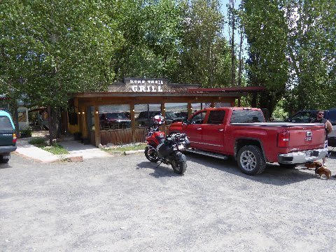
Above: Duc in front of Burr Trail Cafe. Boulder, UT. 16 July 2015.
I enjoyed a burger here. One of the requirements for employment at the Burr Trail Cafe was probably whether one had sufficient tattoos and piercings.
Next door is the Hells Backbone Grille, often written up as a good Utah fine dining option off the beaten track.
A group of us, led by Prosecutor, were kicked out of the Hells Backbone Grill 10 years ago after complaining about the shoe leather steaks and the terrible service.
When the owner finally came out to our table, she said that the reason she hadn't come sooner was that she was talking to the Delai Lama on the phone. Also, our waitress was visiting with a friend that she hadn't seen for years. The owner, not apologetically, told us we could leave without paying. Prosecutor, said, "no way... we're going to pay!" She then went amongst our group saying... "give me some cash! give me some cash!" When she had amassed enough cash to cover the bill and the tip, she tossed it on the table, whereupon we all... seven or eight of us.... tromped out.
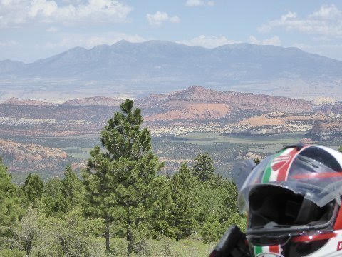
Above: Looking over Waterpocket Fold, east, to the Henry Mountains, from the flank (SR 12) of Boulder Mountain. 16 July 2015.
Boulder Mountain is part of the Aquarius Plateau, which may be one of the reasons that the area (Torrey, Boulder, Escalante) is disproportionately inhabited by converted Bhuddists, hippies etc.
Above: The dome (left) of Capital Reef National Park. Torrey, UT. UT SR 12. 16 July 2015.
That's why its called "Capital" Reef... the dome... get it?
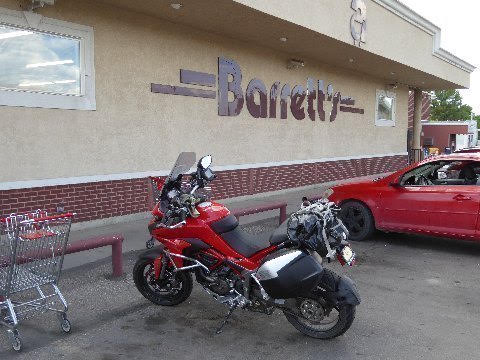
Above: Barretts grocery store in Salina (US 89, US50). 16 July 2015.
I stopped here to buy 10 lbs of the best pork sausage in Utah. I put the sausage and a block of dry ice in the bag on the rear seat of the Duc. The Monk, put me onto this sausage several years ago. I don't pass through Salina but what I don't pick up some sausage at Barretts.
Addendum:
Thanks😝😝and for the opinions of the two wild and crazy guys.
Brand Man
Venice, CA
Karen's family held a family reunion at Big Rock Candy Mountain in 06. We had a wonderful time with ATVs and rafting. We had only two incidents which called for ambulance transport to a hospital, I think it was Richfield's. On the last call we were told to hold our reunion somewhere else the next year. Karen's grandfather owned a large number of sheep\ and her father was left alone on a mountain to with a herd of sheep for three days at the age of eight. He was frightened the first night and slept with a loaded rifle. Among others he herded sheep in the vicinity of the Big Rock Candy Mountain. He was taken out of school when the sheep birthed in the Spring and stayed out until Fall.
Spook,
Reston, VA